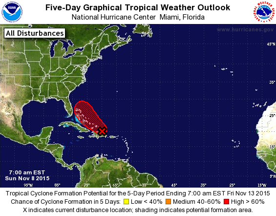
NASSAU, The Bahamas – 7:30pm) The Bahamas Department of
Meteorology continues to monitor the area of disturbed weather located near the
Southeast Bahamas and the Turks and Caicos Islands. At 7:00 pm this evening, the National
Hurricane Center has advised that the showers and thunderstorms, associated
with an area of low pressure located about 60 miles east-northeast of Mayaguana
continues to show signs of organization.
Recent Satellite images indicate that the circulation of the low has
become better defined since this morning.
An Air Force Reserve Hurricane Hunter Aircraft is scheduled to
investigate this system on Monday morning.
Environmental conditions remain favourable
and only a slight increase in organization of the system would result in the
formation of a Tropical Depression (#12) or Tropical Storm (Kate) tonight or
Monday.
Residents in the Turks and
Caicos Islands and the Central and Southeast Bahamas which include the islands
of Inagua, Mayaguana, Long Cay, Acklins, Crooked Island, Long Island, Cat
Island, Exuma, Rum Cay and San Salvador, could experience flooding, as locally
heavy rains and gusty winds are possible across those areas during the next two
days. Residents in these
areas should also be prepared to take quick action in the event a Tropical
Storm Warning is issued sometime during the next 24 hours.