|
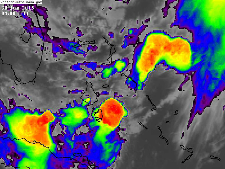
From:TheBahamasWeekly.com Bahamas Weather What we had over Nassau was a ‘Supercell Thunderstorm’ and if you look at the enhanced IR satellite picture taken at 12am this morning, you will see the area I am referring to over South Andros at the time (They reported similar weather conditions from about 11pm to about 1am last night). With these ‘Supercell Thunderstorms’ you can experience 1) Strong vertical up and downdrafts within designated areas mentioned and in the area surrounding these clouds, 2) Dangerous lightning, 3) Hail 4) Significant reduction in visibility, 5) Heavy showers and severe thunderstorms, 6) Strong gusty winds (sometimes up to Tropical Storm strength of 39 mph), 7) Significant wind shear and micro-burst conditions 8) Tornadoes( some persons who I spoke to said the winds sounded like a loud train on the outside-I can’t rule out a tornado briefly touching down but can’t confirm it either without any critical evidence or by looking at the damage) and 9) Significant or severe turbulence.
|