|

|
|
|
Last Updated: Feb 13, 2017 - 1:45:37 AM |
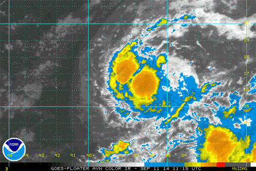
This animated gif shows Edouard slowly spinning over the central Atlantic. (NOAA/Satellite)
|
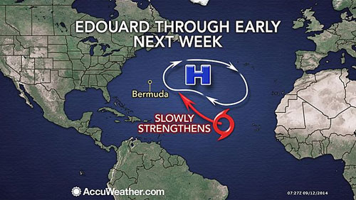
AccuWeather reports conditions are becoming more favorable for Tropical Storm Edouard in the central Atlantic to intensify into a hurricane this weekend.
Prior to Thursday, there have been five tropical depressions with three moving on to become hurricanes (Arthur, Bertha and Cristobal) and one becoming a tropical storm (Dolly).
Early Thursday night, tropical depression five intensified and took on the name Edouard.
Additional development is forecast for Edouard through the weekend as it continues to move into a zone of less dry air and lower disruptive winds.
According to AccuWeather.com Hurricane Expert Dan Kottlowski, "The system should move into more favorable environmental conditions, and this could allow the system to strengthen into a strong tropical storm and perhaps into a hurricane."
Edouard is forecast to take a curved path over the central Atlantic, well away from land areas over the next several days and is likely to steer clear of the Caribbean.
People in Bermuda and the Azores should monitor Edouard for possible impact later next week.
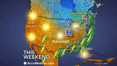
Meanwhile, an area of disturbed weather will cross South Florida during the next couple of days and will produce locally drenching and gusty thunderstorms.
"We are also monitoring a disturbance moving over the southern Gulf of Mexico," Kottlowski said.
"While the window is rather short for development, essentially through Saturday, it is in a region of low disruptive winds and very warm waters."
A steering flow would take this system into southern Texas or northeastern Mexico this weekend.
At the very least, tropical moisture will feed into this zone. When combined with a front approaching from the north, locally drenching rainfall is likely to be released into the weekend over south and coastal Texas and northeastern Mexico this weekend.
Part of south and coastal Texas is experiencing abnormally dry to drought conditions.
Any non-flooding rainfall would generally be welcomed, especially from an agricultural standpoint.
Over the eastern Pacific, there are several systems being monitored. Odile is forecast to take a path paralleling the west coast of Mexico and is likely to through another round of drenching showers and thunderstorms into the southwestern U.S. next week. There is a chance the drenching rain will reach Southern California, including coastal areas.

© Copyright 2014 by thebahamasweekly.com
Top of Page
|
|
|
|