|

|
|
|
Last Updated: Feb 13, 2017 - 1:45:37 AM |
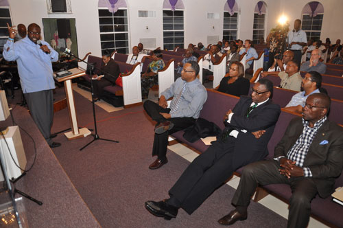
Kenred Dorsett, Minister for the Environment and Housing, addresses residents and stakeholder in East Grand Bahama on the two new proposed marine protected areas for Grand Bahama, the North Shore/the Gap National Park; and East Grand Bahama National Park. On hand for the meeting were, from left to right: Minister for Grand Bahama, Dr Michael Darville, Senator Tanisha Tynes, Peter Turnquest, MP, East Grand Bahama, Agriculture, Fisheries and Marine Resources and Local Government Minister, V. Alfred Gray, and East Grand Bahama Administrator, Sherrick Ellis. (BIS Photo/Vandyke Hepburn).
|
FREEPORT, Grand Bahama…The creation of two National Parks in East Grand Bahama, the Gap Marine Protected Area and the East Grand Bahama Marine Protected Area got the overwhelming support of residents of the area and stakeholders attending a Town Meeting in Pelican Point, June 5, 2014t. During this meeting Government Ministers dispelled the concerns of local fishermen that the areas proposed by the country’s three major conservationist organisations would be declared a "no-take zone", effectively prohibiting fishing.
Minister for the Environment and Housing, the Hon. Kenred Dorsett, MP said the areas being proposed will be given special protection so that substance fishing, diving, boating, and other recreational/commercial activities will be allowed based on the reasons explored in the management plan referenced for the particular area.
Minister Dorsett, the Hon. Minister for Grand Bahama, Dr. Michael Darville, M.P, and Agriculture, Fisheries and Marine Resources and Local Government Minister, the Hon. V. Alfred Gray, M.P. all gave East Grand Bahama residents and others in attendance a clear understanding of what is being proposed as they viewed it as an important topic to the livelihood and wellbeing of the residents of East Grand Bahama and Grand Bahama as a whole.
The proposals advanced by Non-Governmental Agencies the Bahamas National Trust, the Bahamas Reef Environmental Education Foundation (BREEF), and The Nature Conservancy following earlier consultancy and discussions with East End residents that yielded the boundaries that are expected to be forwarded to the Government as a part of a Grand Bahama Marine Protected Area that will create the North Shore GAP Marine Protection Area, and the East End Marine Protection Area.
Minister Dorsett then visited the history of marine protected areas in The Bahamas, and made the following presentation.
THE PROPOSED PROTECTED AREAS
1. The North Shore – The Gap National Park
This proposed area is approximately 280,000 acres and Grand Bahamians know this area as “The Gap.” This name dates back to the 1950s at North Riding Point, when the pulpwood loading terminal was constructed.
Workers and their families lived at a logging camp community of 200 homes near the terminal, and this community of residences became known as “the Gap.” Although these settlers dispersed at the end of the logging period, the area has retained the name to this day. The physical attributes of this area consists of –
● Mangrove wetlands;
● Tidal creeks, sand and mud flats;
● Beach strand and rocky shores,
● Blue holes; and
● An unexplored karst cave system northeast of Dover Sound.
The Map of North Shore, ‐ The Gap, Grand Bahama proposed in the White Paper covered a given area at Figure 1. However, in order to meet The Bahamas obligations under the CCI, this area was extended to resemble a ‘rectangle’ shaped area at Figure 2. Extensions were also proposed for the Peterson Cay National Park and the Lucayan National Park.
It is noteworthy to mention 50 percent of the land within the park is owned by the Grand Bahama Development Company and the Grand Bahama Port Authority. Beyond the boundaries of Freeport are the government owned land. Water Cay is the only inhabited area in this proposed site. However, the waters surrounding this cay are earmarked for protection.
2. East Grand Bahama National Park
This area is located south of Sweetings' Cay, and spans over 12,500 acres. Many fishing habitats exist because of the tidal creeks in the area. The cited area possesses –
● Mangrove forests;
● Offshore reef system;
● Explored blue hole systems; and an
● Undisturbed underground karst systems.
Recently, a rapid ecological assessment was completed in this area by the Bahamas National Trust that has given us biological information on the health of the marine and terrestrial ecosystems and the areas important for bonefish.
The Member of Parliament for East Grand Bahama, Peter Turnquest, admonished all residents and stakeholders in attendance to take the opportunity to pose their questions of concern to the Government Ministers and NGOs.
THE HISTORY OF MARINE PROTECTED AREAS IN THE BAHAMAS
During the 1980s The Bahamas Government asked the Bahamas National Trust to propose additional sites that could be added to the National Park System. A proposal was submitted on August 10, 1983 that included the following sites in Grand Bahama as a possible marine protected areas:
• Grand Bahama’s Eastern Cays National Reserve
• Peterson’s Cay Extension National Park;
• Theo’s Wreck Protected Area; and
• Treasure Reef Protected Area.
Then, later in 1998, The Bahamas Reef Environment and Educational Foundation sponsored a workshop in conjunction with the Department of Fisheries and the Bahamas National Trust to discuss the creation of a Network for Marine Reserves for The Bahamas. A list of specific marine reserve areas were recommended. Subsequently in the year 1999, three experts on the marine ecology of The Bahamas, Dr. Allan Stoner, Dr. Mark Hixon and Dr. Craig Dahlgren were invited to review a list of marine reserve sites that were proposed by the Department of Fisheries. They produced the document entitled “Scientific Review of the Marine Reserve Network Proposed for the Commonwealth of The Bahamas.”
This document suggested 39 sites throughout The Bahamas that fit the criteria to be designated marine reserves. The list was devised based on socio‐economic (that is their importance in safeguarding livelihoods based on the sea and food from the sea) and ecological importance.
In 1999, the Government announced its plan to establish a Marine reserve network that would include 20 percent of the Bahamian marine environment. However, it was not until 2009 that five locations were finally declared as protected areas under the Fisheries Resources (Jurisdiction and Conservation
Act ). They were as follows:
• Abaco Cays
• Berry Islands.
• Bimini
• South Eleuthera
• Exuma.
No fishing was to take place in these areas and they were to form the nucleus of the Network of Marine Reserves in The Bahamas.
At the 7th Conference of the Parties in 2008, The Bahamas agreed to the Programme of Work on Protected Areas. To help The Bahamas meet its commitments under this programme, the Global Environment Facility Full Size Project entitled, “Building a Network of Marine Protected Areas in The Bahamas” was formulated. A component of this project is the expansion of The Bahamas Protected Areas Network.
In the same year, The Bahamas became a part of the Caribbean Challenge Initiative (CCI). This initiative is the first conservation effort adopted by governments in the region to provide sustainable financing for the effective management of protected areas. Participating countries have committed to protecting at least 20 percent of near‐shore marine and coastal environments by 2020, and creating a national conservation trust fund with a sustainable finance mechanism that is dedicated to management of these protected areas.
A White Paper entitled, “The Expansion of the Protected Areas System of the Commonwealth of The Bahamas” was developed by the Bahamas Environment Science and Technology Commission, the Bahamas National Trust, The Nature Conservancy and the Department of Marine Resources to meet the Caribbean Challenge Initiative. The paper identified recommended protected areas that are rich in biodiversity. Late last year this proposal was sent to the Cabinet of The Bahamas for its official endorsement. In the interim, the Bahamas Protected Areas Fund Bill 2013 was debated in the House of Assembly. The Bill is presently being debated in the Senate. It is expected that this Bill will be law soon. When enacted, the Bahamas Protected Areas Fund will keep an accurate register of marine protected areas and will revolutionise the way these areas are managed in The Bahamas because of the suitable source of funding that will be readily available.
Minister Dorsett closed by telling his audience that his Ministry forwarded for Cabinet’s consideration a schedule of town meetings to discuss with key stakeholders and the general community in the islands that have been identified for Marine Protected Areas. Hence, ladies and gentlemen, this is why we are here today. The two new areas under consideration are –
• The North Shore/ the Gap National Park; and
• East Grand Bahama National Park.
Additionally, there two existing parks being considered for expansion:
• Lucayan National Park
• Peterson Cay National Park

© Copyright 2014 by thebahamasweekly.com
Top of Page
|
|
|
|


