|
Last Updated: Feb 13, 2017 - 1:45:37 AM |
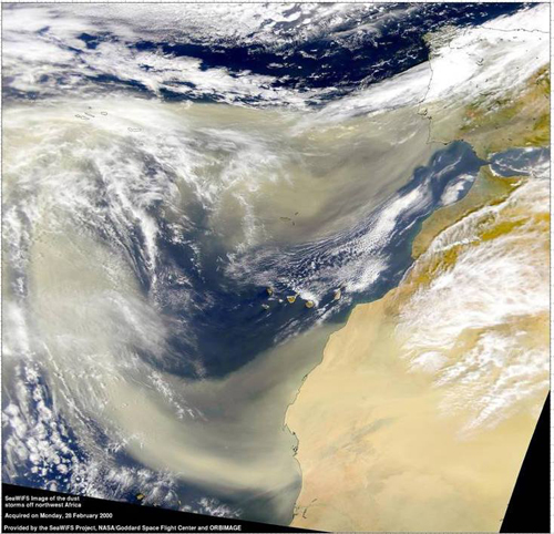
Image from the National Hurricane Center
|
Bahamian meteorologist, Wayne Neely provides us with a weather update on August 5th, 2015:
It looks like another event of Saharan dust will be over us for the
next three to four days. It makes the sky appear milky white and the
boundary of the clouds appears to be blending in with the milky white
sky. During this Sahara dust ‘event’ it tends to significantly inhibit
convective activity (thunderstorms and showers)-It doesn’t prevent them
all together but it significantly lessens their activity. It also gives
the sun a very noticeable 'red hue' especially at sunrise
and sunset.
This is the same dust in the atmosphere that prevented
significant tropical cyclone development for the last two years over the
North Atlantic. All the haze shrouding The Bahamas this week may not be
great for your health, but it has a major benefit: It helps stymie
hurricanes and tropical storms. The haze actually is Saharan dust that
drifted more than 4,000 miles from Africa, and abnormally heavy
concentrations currently are blanketing the main region of the Atlantic
where storms develop. The dust, denies the systems of their lifeblood -
heat and moisture.
In The Bahamas, the dust is expected to remain
thick, possibly for the rest of the week. It has lowered air quality
from the good to moderate range. If you have extreme respiratory
problems, stay inside air-conditioned facilities to minimize exposure.
Anyone who works outside for any length of time also should be careful
because of the combination of dust and high heat. Dust outbreaks occur
when strong winds lift clouds of particles from the Sahara desert. Winds
or tropical waves – areas of low pressure – then push the dust west
across the Atlantic. Because the Sahara has been superheated this year,
making its surrounding atmosphere unstable, the dust outbreaks have been
more frequent and expansive than usual.

© Copyright 2015 by thebahamasweekly.com
Top of Page


